San Luis Peak
& Mount Lindsey
San Luis
Peak & Mount
Lindsey
Colorado
September 21-27, 2025
San Luis Peak is a mellow class one hike in Colorado’s San Juan range and stands pretty isolated from the rest of the San Juan 14ers.
The 14,022 foot peak is about a 90 minute drive from Lake City where I had hiked Handies with the crew the day prior. 

There are two routes up San Luis Peak. Just south of Gunnison is San Luis Peak via Stewart Lake Trail which is 3,500 feet over 13 miles and is considered the standard route. Outside of Creede is the San Luis Summit Trail and is 3,500 feet over 11 miles. I opted for the route outside of Creede as it was closer and easier to access from Lake City.
The dirt road out of Creede leading to the trailhead was very scenic with the foliage and is totally manageable.
The AllTrails directions only brings you to the start of the actual 4WD road. This 4WD road is another 20 minutes or so to the actual trailhead. It isn’t too bad either but the higher clearance and 4WD definitely helped. This would be a lot of fun on the way out with the massive rain puddles.
Sunrise views of San Luis Peak
It poured over night and I had a horrible sinus headache so I didn’t sleep very much. I started around 5am on Sunday 9/21/25 and there were only a few other cars in the lot, it would be a fairly low traffic trail overall.

You ascend maybe 800 feet up and over the initial ridge and into the valley. It’s a super beautiful trail and the sunrise through the clouds was top notch. It was pretty overcast in the morning but I didn’t encounter any bad weather on the way up or down. This portion of the trail up to San Luis Peak intersects with the Continental Divide Trail and I met a couple through hikers on the way down. 
Eventually the dirt turns to rock and you ascend the final ridge up to the summit.
It was completely socked in for the last 500 feet or so, but below the cloud cover on the saddle the views were pretty epic. The hike took me about 5.5 hours total, I made a coffee at the trailhead, and I began the 5 hour drive back to Denver. 
A view of San Luis Peak from the saddle before the final ridgeline, and the socked in summit
The following Saturday 9/27/25, Brian and I headed south to hike Mount Lindsey, a solo fourteener in the Sangre de Cristo Range standing at 14,048 feet.
Mount Lindsey Trail is 8 miles and 3,600 feet and rated a class three hike. As promised the access road from the town of Gardner is quite a ways and you pass several privately owned ranches. The actual trailhead is about 30 minutes past the AllTrails directions and the road isn’t that bumpy at all, the last couple miles are the worst part but passable by a SUV. It was a gorgeous night and we camped out for our early start.
The iron nipple (left) and Mount Lindsey (right) silhouetted as the sun rose in the valley
We started just before 5am and the trial begins as a super mellow walk in the woods along the creek.
After about a mile and a half the trail gets really steep really quick. As you ascend above tree line you pass up and through a beautiful valley to the class three portion of the day. We had beautiful sunrise views at this point and you can see Iron Nipple and Mount Lindsey to the left and Blanca Peak to the right. 

The final ridge to the summit is technically in private land. The peak was closed last year (assuming this was because of private ownership) so we were pleased it was open this year.  There is a sign as you pass into the private property and you’re supposed to sign a waiver to hike to the top.
Early morning view of Blanca Peak
Sunrise in the valley (image 1), the view of Mount Lindsay before the final class 3 section (image 2), Brian just before the crux of the hike (image 3), views of Blanca and Ellingwood to the left (image 4)
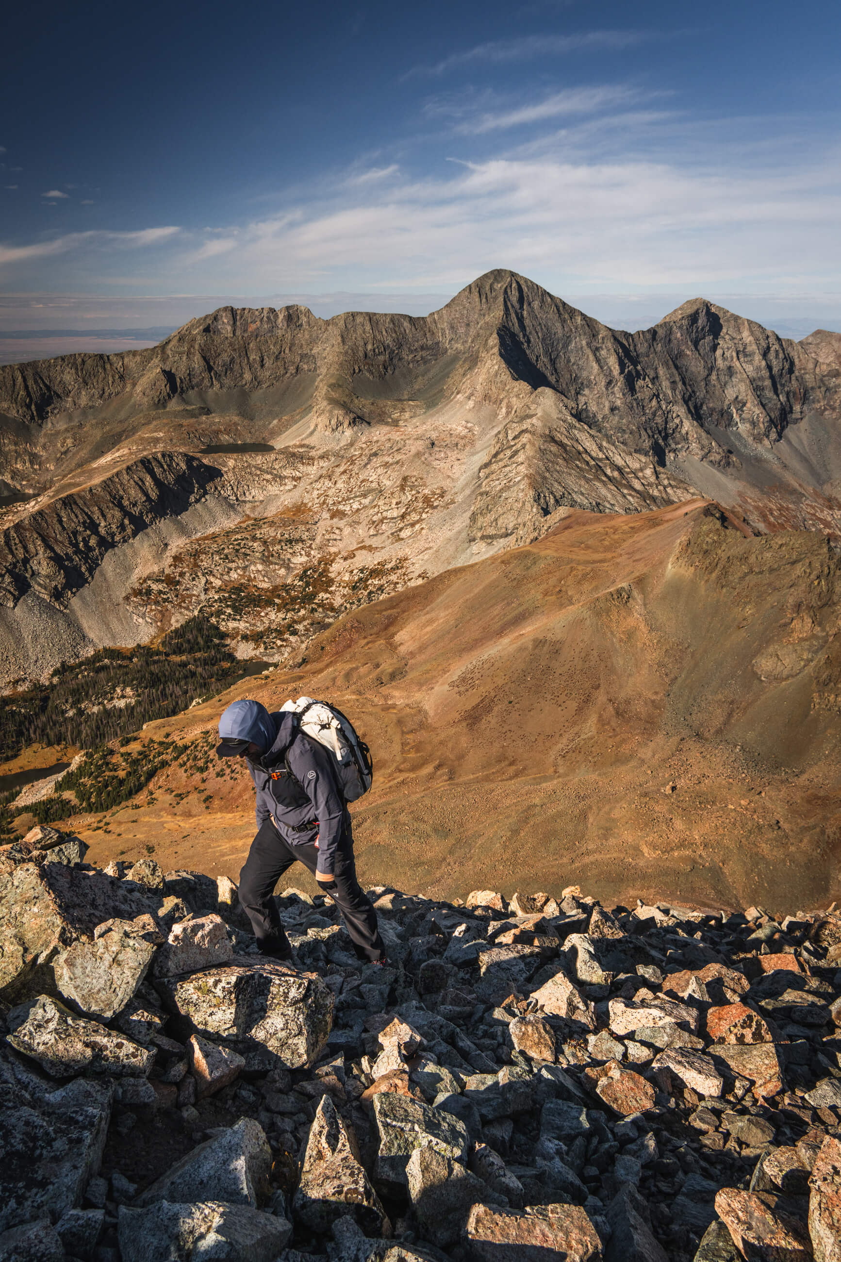
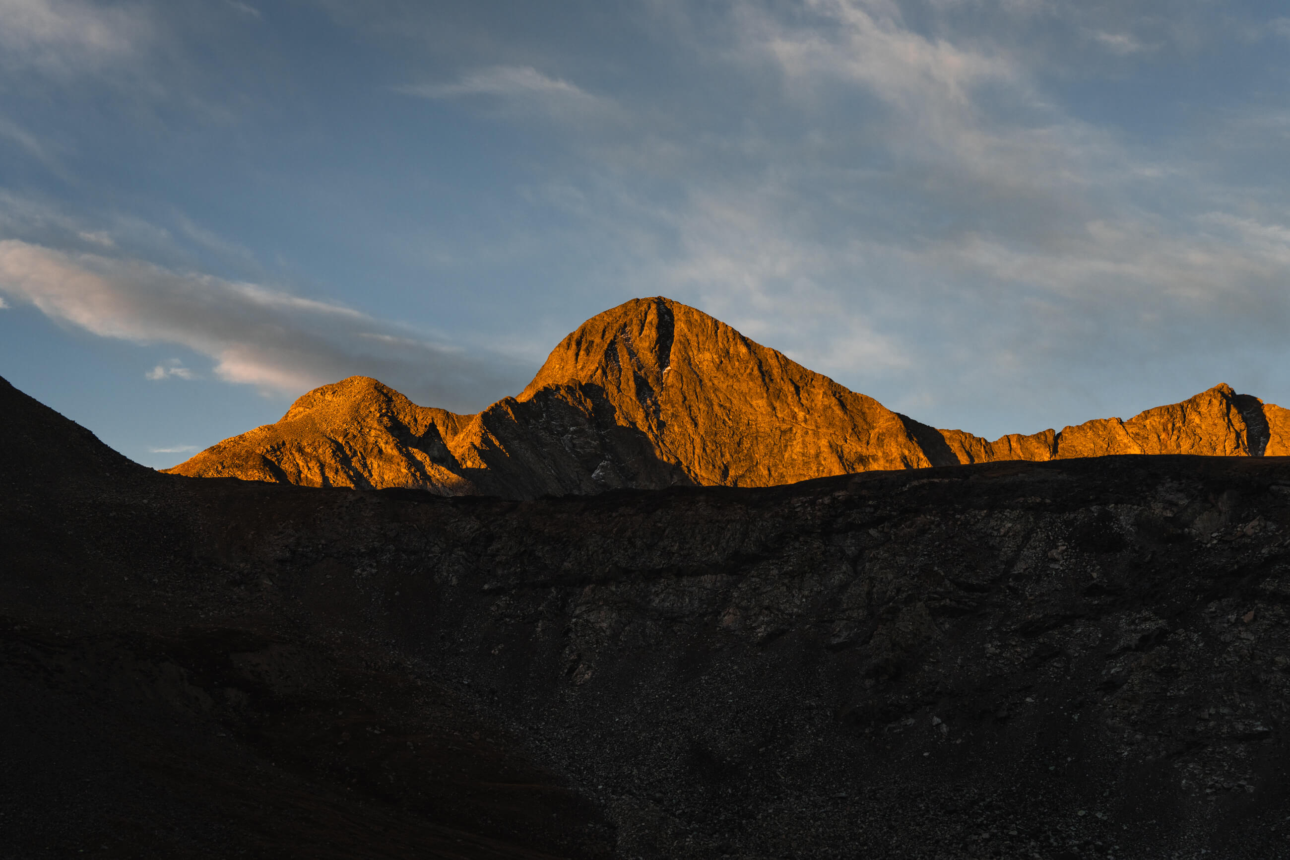
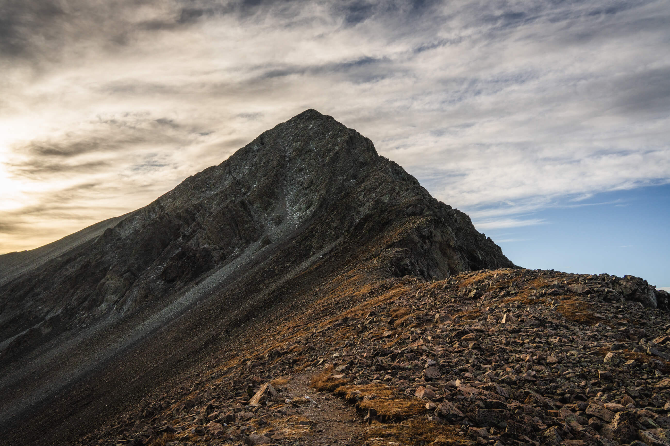
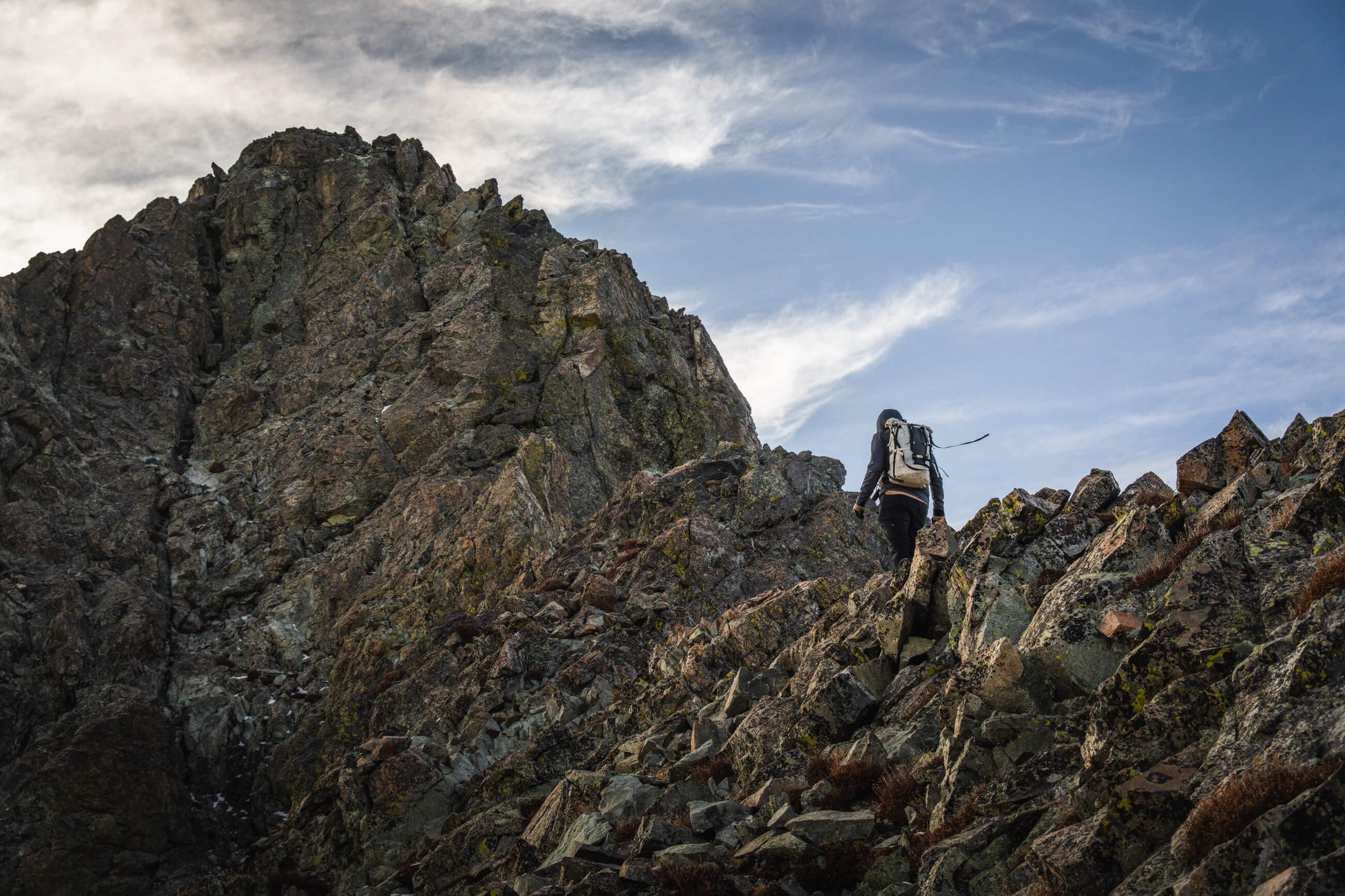
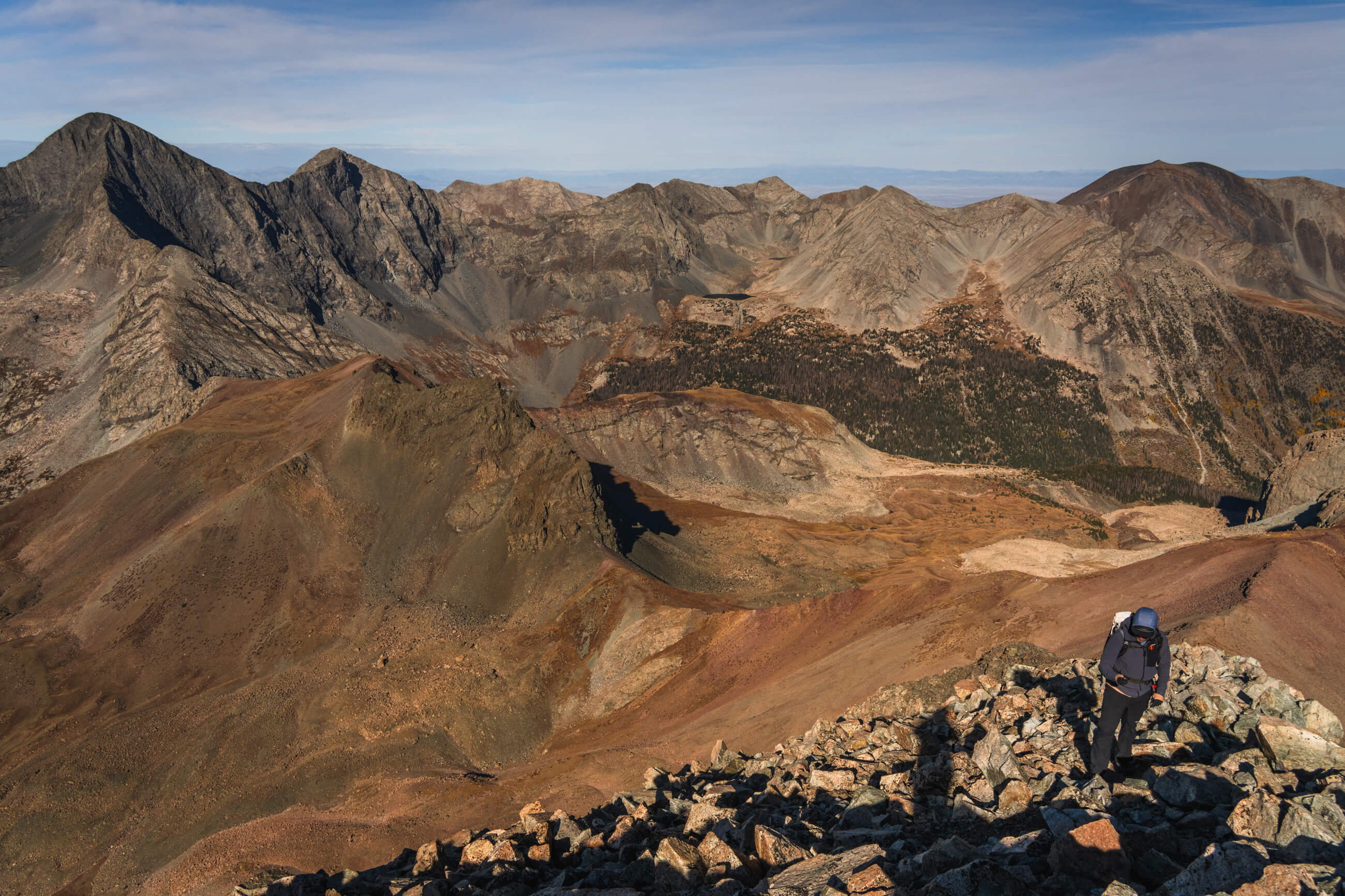
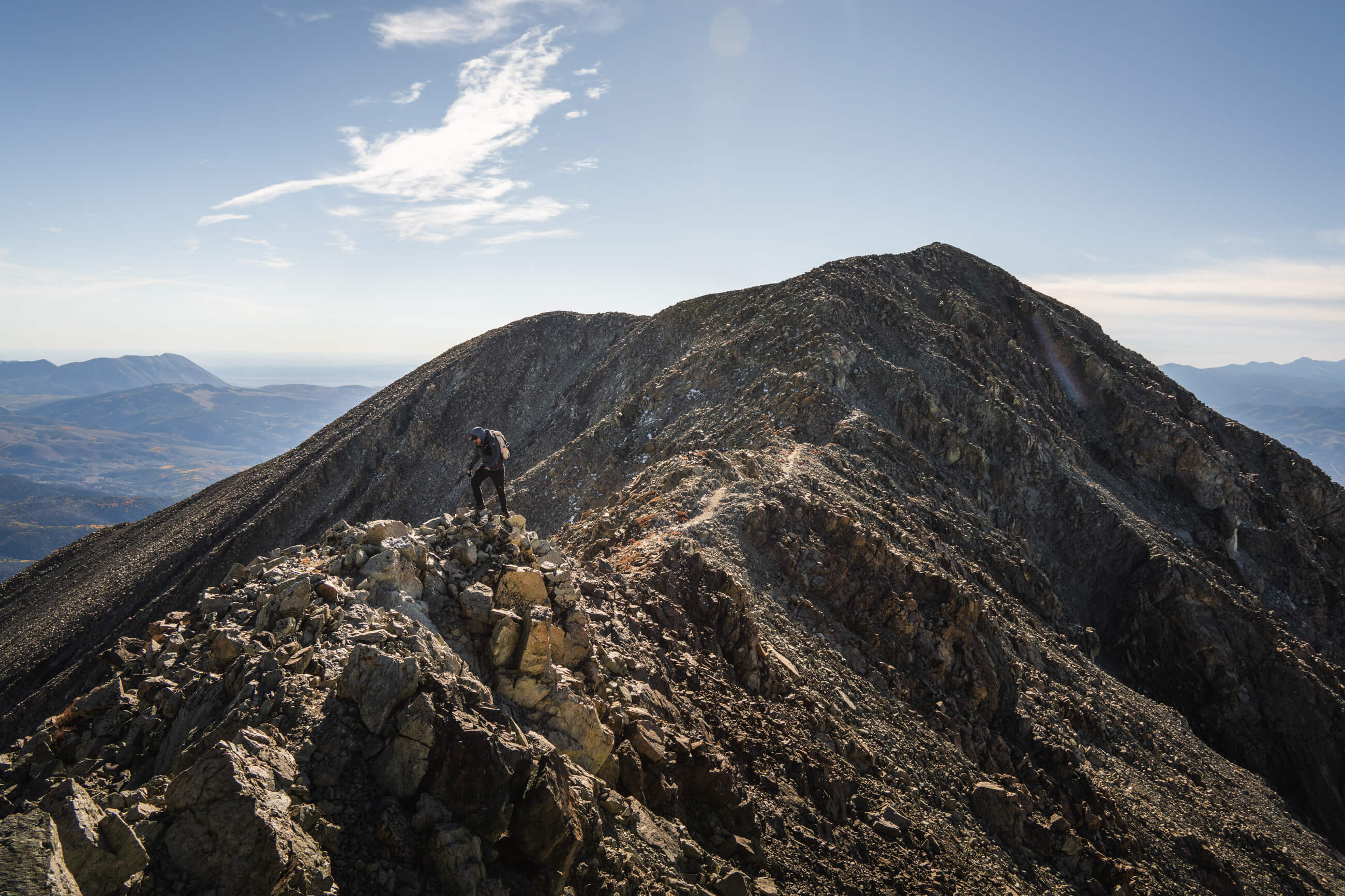
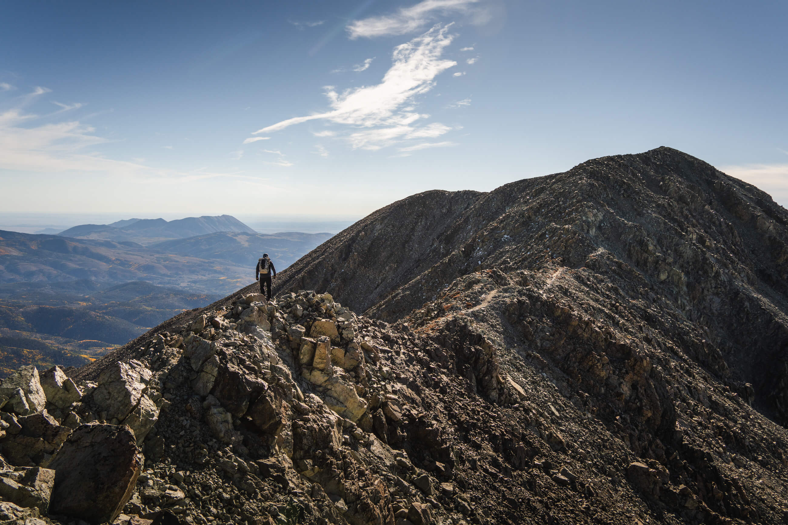
The final thousand feet to the top looks worse than it actually is. There are two ways up to the summit, the gully or the ridge. While the gully is technically rated as “easier” it’s full of loose rock and the general consensus is to take the ridge up and down. We ascended and descended via the ridge and that’s definitely the way to do it. There’s some moderate exposure and you’ll want to check the handholds, there’s some loose rock. 

You want to stay pretty high on the ridge but before the crux (the steep wall with the crack in it) you want to stay a little lower on the climber's left side and traverse along the wall. (The pictures from 14ers.com are always helpful to have saved on the phone).
The easiest way up and around the crux is to probably ascend to the left of the crack. We opted to climb up the chimney at the top for some extra spiciness. 
The false summit is just above this crux and then it’s a quick ridge walk to the actual summit. This portion isn’t bad at all. You have some great close up views of Blanca, Ellingwood, and Little Bear to the southwest and a distant view of the Crestones to the north. We had a nice hour at the top and before heading back to the car. The day took us about eight hours total. 
Little Bear, Blanca, and Ellingwood from left to right (image 1), Brian ascending the final section to the true summit (images 2 & 3)